
Introduction
Google Maps is the most spectacular app through which our day-to-day life becomes easier.
The database records hold the latitude and longitude information. It will be used to populate Google Maps with multiple markers in ASP.NET MVC Razor.
Description
In this article , I will show you how to show a marker on places like country, state, continent etc., using stored procedure.
To know more details about Google Map, go through my blogs and articles related to Google Map in MVC.
http://www.c-sharpcorner.com/members/satyaprakash-samantaray
Steps to be followed are given below.
Step1
Create a table named MyPlaces.
Table Script
- CREATE TABLE [dbo].[MyPlaces](
- [CityName] [varchar](50) NOT NULL,
- [CityLatitude] [numeric](18, 6) NOT NULL,
- [CityLongitude] [numeric](18, 6) NOT NULL,
- [CityDescription] [varchar](300) NULL,
- CONSTRAINT [PK_Table_1] PRIMARY KEY CLUSTERED
- (
- [CityName] ASC
- )WITH (PAD_INDEX = OFF, STATISTICS_NORECOMPUTE = OFF, IGNORE_DUP_KEY = OFF, ALLOW_ROW_LOCKS = ON, ALLOW_PAGE_LOCKS = ON) ON [PRIMARY]
- ) ON [PRIMARY]
- GO
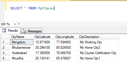
Step 2
Create a stored procedure named Sp_GeoLoc.
Stored procedure script
- Create Procedure Sp_GeoLoc
- As
- Begin
- SELECT * FROM MyPlaces
- End
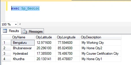
Execute the stored procedure.
- exec Sp_GeoLoc
Step 3
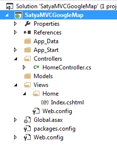
Create a MVC 5 Application named SatyaMVCGoogleMap.
Step 4
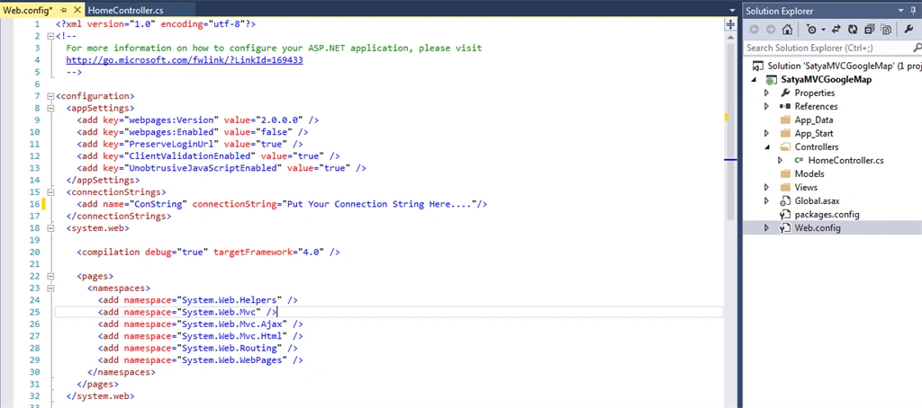
Put the connection string in Web.Config file.
Code ref
- <connectionStrings>
- <add name="ConString" connectionString="Put Your Connection String Here...."/>
- </connectionStrings>
Code description
This adds name ConString, which is important to add in controller class file to access the table and the stored procedure.
Step 5
Add a controller class file named HomeController.cs.
Code ref
- using System;
- using System.Collections.Generic;
- using System.Linq;
- using System.Web;
- using System.Web.Mvc;
- using System.Configuration;
- using System.Data.SqlClient;
- namespace SatyaMVCGoogleMap
- {
- public class HomeController : Controller
- {
- // GET: Home
- public ActionResult Index()
- {
- string markers = "[";
- string conString = ConfigurationManager.ConnectionStrings["ConString"].ConnectionString;
- SqlCommand cmd = new SqlCommand("Sp_GeoLoc");
- using (SqlConnection con = new SqlConnection(conString))
- {
- cmd.Connection = con;
- con.Open();
- using (SqlDataReader sdr = cmd.ExecuteReader())
- {
- while (sdr.Read())
- {
- markers += "{";
- markers += string.Format("'title': '{0}',", sdr["CityName"]);
- markers += string.Format("'lat': '{0}',", sdr["CityLatitude"]);
- markers += string.Format("'lng': '{0}',", sdr["CityLongitude"]);
- markers += string.Format("'description': '{0}'", sdr["CityDescription"]);
- markers += "},";
- }
- }
- con.Close();
- }
- markers += "];";
- ViewBag.Markers = markers;
- return View();
- }
- }
- }
Code description
You will need to import the namespaces given below.
- using System.Configuration;
- using System.Data.SqlClient;
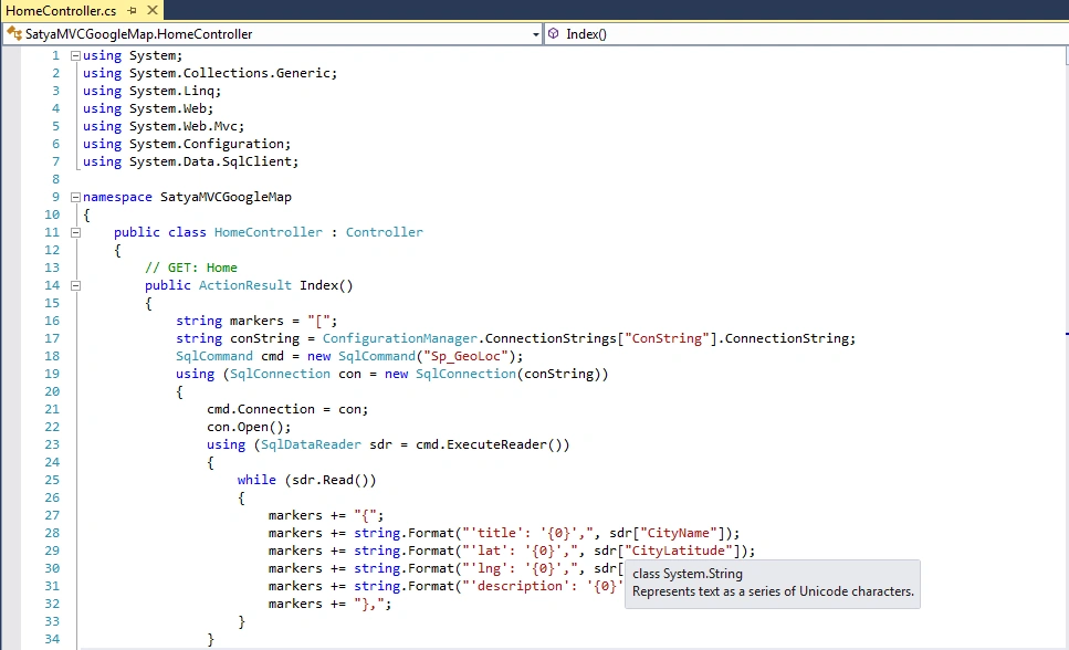
Controller consists of the Index Action method. Inside this Action method, the records are fetched from the MyPlaces Table, using Sp_GeoLoc Stored Procedure .
Google Map needs an array of markers, which consists of CityName, CityLatitude, CityLongitude and CityDescription and hence a JavaScript Array is built from the fetched location records with the help of the string concatenation.
The generated string is assigned to a ViewBag object.
Using ADO.NET concept, I added my connection string reference add name and the stored procedure.
- string conString = ConfigurationManager.ConnectionStrings["ConString"].ConnectionString;
- SqlCommand cmd = new SqlCommand("Sp_GeoLoc");
With the help of string concatenation, all the column values are put in markers variable.
The array of markers which consists of CityName, CityLatitude, CityLongitude and CityDescription and hence a JavaScript array is built from the fetched location records with the help of string concatenation.
- string markers = "[";
- using (SqlDataReader sdr = cmd.ExecuteReader())
- {
- while (sdr.Read())
- {
- markers += "{";
- markers += string.Format("'title': '{0}',", sdr["CityName"]);
- markers += string.Format("'lat': '{0}',", sdr["CityLatitude"]);
- markers += string.Format("'lng': '{0}',", sdr["CityLongitude"]);
- markers += string.Format("'description': '{0}'", sdr["CityDescription"]);
- markers += "},";
- }
- }
- markers += "];";
- ViewBag.Markers = markers;
Create a view named “Index.cshtml”.
Code ref & code description
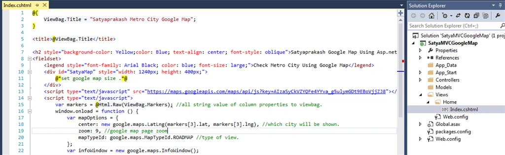
In this section, I added the code description with Green commented line besides the code.
- @{
- ViewBag.Title = "Satyaprakash Metro City Google Map";
- }
- <title>@ViewBag.Title</title> //The Title will show Here.
- <h2 style="background-color: Yellow;color: Blue; text-align: center; font-style: oblique">Satyaprakash Google Map Using Asp.net MVC</h2>
- <fieldset>
- <legend style="font-family: Arial Black; color: blue; font-size: large;">Check Metro City Using Google Map</legend>
- <div id="SatyaMap" style="width: 1240px; height: 400px;">
- @*set google map size .*@
- </div>
- <script type="text/javascript" src="https://maps.googleapis.com/maps/api/js?key=AIzaSyCkVZYQFe4YYva_g5ulymGDt9EBoVjjZJ8"></script> @*api key after sign in your google account.*@
- <script type="text/javascript">
- var markers = @Html.Raw(ViewBag.Markers); //all string value of column properties to viewbag.
- window.onload = function () {
- var mapOptions = {
- center: new google.maps.LatLng(markers[3].lat, markers[3].lng), //which city will be shown.
- zoom: 9, //google map page zoom
- mapTypeId: google.maps.MapTypeId.ROADMAP //type of view.
- };
- var infoWindow = new google.maps.InfoWindow();
- var map = new google.maps.Map(document.getElementById("SatyaMap"), mapOptions);//pass div id and google map load values.
- for (i = 0; i < markers.length; i++) { //here load all city map name
- var data = markers[i]
- var myLatlng = new google.maps.LatLng(data.lat, data.lng); //here i assigned lat and long.
- var marker = new google.maps.Marker({
- position: myLatlng, //lat and long value
- map: map, //div id
- title: data.title //city name
- });
- (function (marker, data) { //here city map description after click on it.
- google.maps.event.addListener(marker, "click", function (e) {
- infoWindow.setContent(data.description); //city description value
- infoWindow.open(map, marker); //then pop will show the description
- });
- })(marker, data);
- }
- }
- </script>
- </fieldset>
- <footer>
- <p style="background-color: Yellow; font-weight: bold; color:blue; text-align: center; font-style: oblique">© @DateTime.Now.ToLocalTime()</p> @*Add Date Time*@
- </footer>
View consists of an HTML DIV element, which will be used to load and display Google Map.
The markers array built inside Controller are assigned to the markers JavaScript variable. Inside the JavaScript Window, OnLoad event handler, first, Google Maps are displayed inside HTML DIV element and then using a loop, marker is plotted on the map for each city present in the array.
Step 7
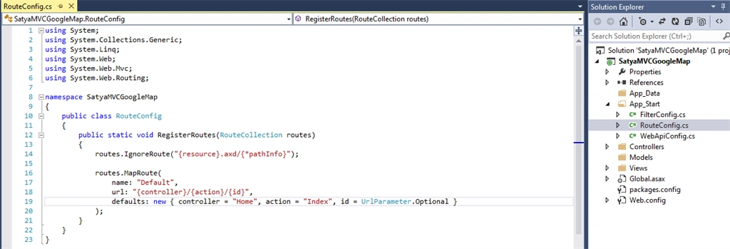
Set start page in “RouteConfig.cs”.
Code ref
- routes.MapRoute(
- name: "Default",
- url: "{controller}/{action}/{id}",
- defaults: new { controller = "Home", action = "Index", id = UrlParameter.Optional }
- );
Here, the name of the controller is Home.
Here, name of the view or controller action method is Index.
Output
URL is http://localhost:57131/Home/Index
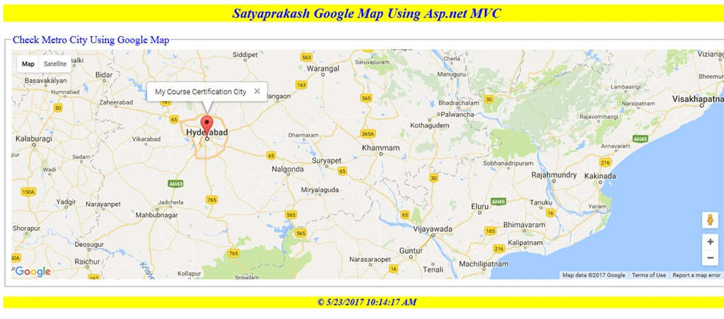
At first, load the page and the city is shown, as I mentioned.
- center: new google.maps.LatLng(markers[3].lat, markers[3].lng)
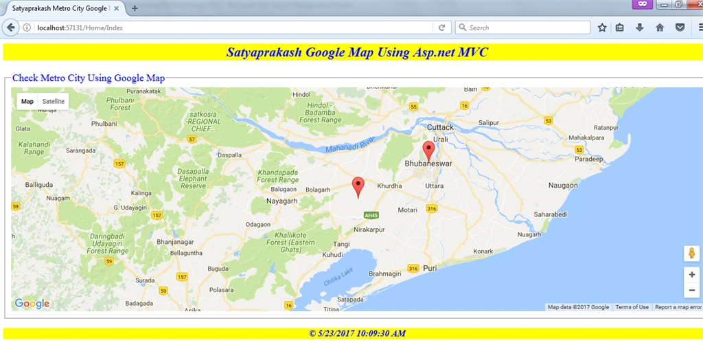
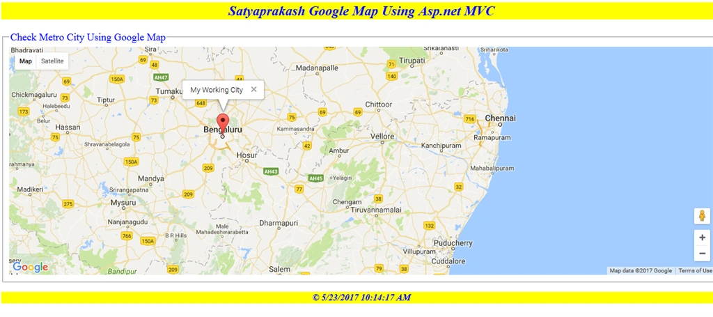

All the cities with Google Markers Icon are shown, using SQL Server stored procedure.
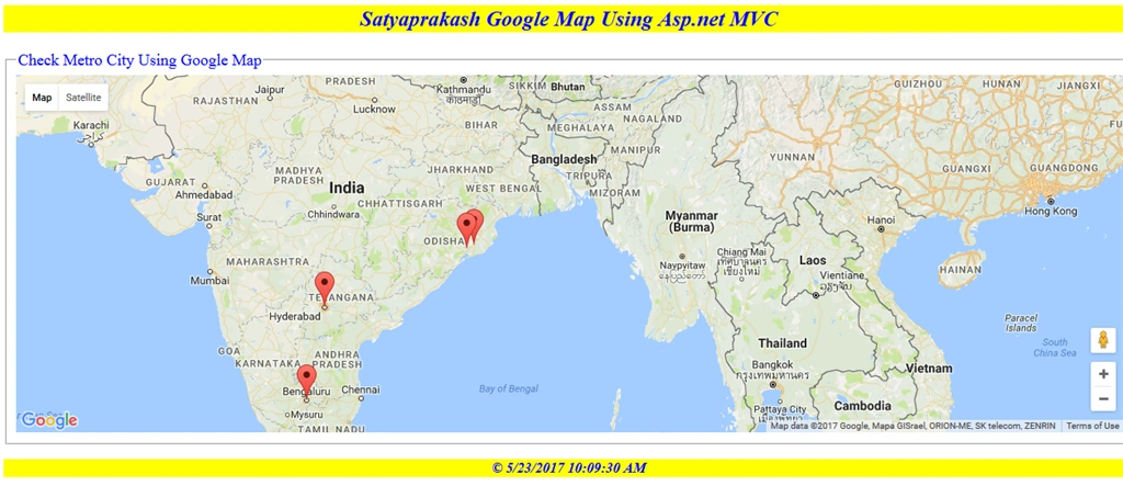
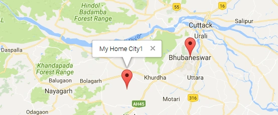
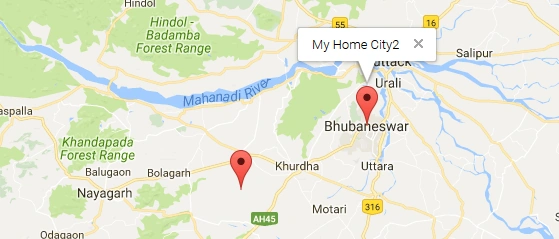
We need to check for city decsription of Bengaluru, Bhubaneswar, Hyderabad, Khurdha.
Summary
- Google map marker placements, using stored procedure.
- City description details.
- Instead of mentioning longitude and latitude in view section manually, you can get those from the database.
- Implement ADO.NET in ASP.NET MVC.
Rizwan AliPosted May 11, 2022, 4:20 PM
Sir thanks for the Article Sir i have a question how can we connect these points to each other and make a geo fence plz sir rply me i am waiting your answer thanks
Android ShowPosted Apr 28, 2019, 8:08 AM
Map is not displayed, API I have. the map does not display
ABHIMANYU SINGHPosted Dec 22, 2018, 9:20 PM
Nice article, However, I am new to asp.net development (webform) and was trying to convert the code to asp.net. I am not sure, how I can pass the markers string in to clientside javascript to generate the map. Any help will be highly appriciated.
ABHIMANYU SINGHPosted Dec 22, 2018, 9:17 PM
Hi Satyaprakash,
Harshavradhan AdawadkarPosted Dec 7, 2018, 6:12 AM
Sir Its Working but Graph was not generated.....
Sachin ChourasiaPosted Jul 23, 2017, 8:18 AM
Gud one................
Former memberPosted May 24, 2017, 7:47 AM
Nice article shared.