

This article shows how to create an application that fetches multiple addresses from a database, calculates their longitude and latitude and then plots the location on the Google map dynamically.
Here, I use the "GoogleMaps.LocationServices" API to get the longitude and latitude of an address.
"GoogleMaps.LocatinServices" is a simple library that allows you to translate latitude/longitude to a region (state) and an address to a map point.
You can install it in your application by running the following command in the Package Manager Console:
PM> Install-Package GoogleMaps.LocationServices
Or you can download it from:
http://www.nuget.org/packages/GoogleMaps.LocationServices/
Let's now proceed to create the application.
First, suppose I have a database table that contains the multiple address. Each row in the table specifies a unique address, including Address, City, State, Zip and Country.
Now, I fetch this table in an ASP.NET application and load it into a DataTable object.
Note: Here, I skip the DataAccess layer to fetch the records from the database.
After getting all records from the database, then calculate the latitude / longitude of each address using the "GoogleLocationService" API.
For this purpose, I create a method that calculates the latitude / longitude of each address and stores them in a List Obect.
I have also defined a class to store various properties of an address to be displayed on the map.
Here is the class declaration.
- public class ProgramAddresses
- {
- public ProgramAddresses()
- {
- }
- public string description { get; set; }
- public double lng { get; set; }
- public double lat { get; set; }
- }
- using System.Runtime.Serialization.Json;
- using GoogleMaps.LocationServices;
In the following method, a list of all objects of the "ProgramAddresses" class are created and then this list is serialized to a JSON string using "JsonSerializer". After that, register this JsonString to the client-side using the "RegisterArrayDeclaration"() method.
- private void BindGMap(DataTable datatable)
- {
- try
- {
- List<ProgramAddresses> AddressList = new List<ProgramAddresses>();
- foreach (DataRow dr in datatable.Rows)
- {
- string FullAddress = dr["Address"].ToString() + " " + dr["City"].ToString() + ", " + dr["Country"].ToString() + " " + dr["StateName"].ToString() + " " + dr["ZipCode"].ToString();
- ProgramAddresses MapAddress = new ProgramAddresses();
- MapAddress.description = FullAddress;
- var locationService = new GoogleLocationService();
- var point = locationService.GetLatLongFromAddress(FullAddress);
- MapAddress.lat = point.Latitude;
- MapAddress.lng = point.Longitude;
- AddressList.Add(MapAddress);
- }
- string jsonString = JsonSerializer<List<ProgramAddresses>>(AddressList);
- ScriptManager.RegisterArrayDeclaration(Page, "markers", jsonString);
- ScriptManager.RegisterStartupScript(Page, Page.GetType(), Guid.NewGuid().ToString(), "GoogleMap();", true);
- }
- catch (Exception ex)
- {
- }
- }
I have created a "GoogleMap()" method at the client-side to plot the location on the Google map.
Add the following script to the aspx page:
- <script type="text/javascript" src="https://maps.googleapis.com/maps/api/js?key=AIzaSyD4IuRFVcMjWo1qWvBrS3v4uvDXcCiq_c4&sensor=false">
The following is the Client-side GoogleMap() method functionality. In this JavaScript method, I used the jsonString to fetch the value that I registered in the pervious step. Going through the loop on the JsonString and plotting each location on the Google map.
- $(document).ready(function () {
- function GoogleMap() {
- var mapOptions = {
- center: new google.maps.LatLng(markers[0][0].lat, markers[0][0].lng),
- zoom: 2,
- mapTypeId: google.maps.MapTypeId.ROADMAP
- };
- var infoWindow = new google.maps.InfoWindow();
- var map = new google.maps.Map(document.getElementById("map_canvas"), mapOptions);
- for (i = 0; i < markers[0].length; i++) {
- var data = markers[0][i];
- var marker = new google.maps.Marker({
- position: new google.maps.LatLng(data.lat, data.lng),
- map: map
- });
- (function (marker, data) {
- google.maps.event.addListener(marker, "click", function (e) {
- infoWindow.setContent(data.description);
- infoWindow.open(map, marker);
- });
- })(marker, data);
- }
- }
- }
- <div id="map_canvas" style="border-top: none; width: 100%; margin-top: -1px; height: 250px; background-color: #FAFAFA; margin-top: 0px;">
- </div>
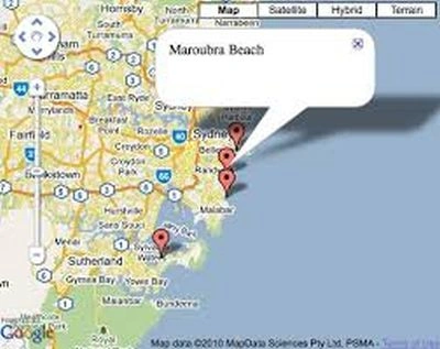
The application displays the output like this:
SanjeevPosted Feb 8, 2024, 4:19 AM
If possible plx provide us full code with download option it will helpful for everyone.
SanjeevPosted Feb 8, 2024, 4:18 AM
If possible plx provide us full code with download option it will helpful for everyone.
SanjeevPosted Feb 8, 2024, 4:16 AM
Wll u provide me JsonSerializer method
Kevin OneslagerPosted Oct 11, 2021, 7:25 PM
I get the following error: The non-generic type 'JsonSerializer' cannot be used with type arguments. This is after installing System.Text.Json and adding Using System.Text.Json; to the cs file. Help!!
Magazzino MagazzinoPosted Jul 15, 2021, 8:01 AM
Sorry,System.Text.Json return a compilation error
asprabaharPosted May 23, 2021, 9:53 AM
Use using System.Text.Json; to resolve the issue "The name 'JsonSerializer' does not exist"
ritu cdPosted Sep 13, 2018, 1:37 AM
ScriptManager.RegisterArrayDeclaration(Page, "markers", jsonString); error on "Page"
Karan SidhuPosted May 13, 2015, 3:19 AM
The issue i am facing is that it does not show the map at all and i get a Reference error saying GoogleMap is not defined
InteGen ChinmayaPosted Apr 27, 2015, 6:24 AM
using Newtonsoft.Json; add this
Cherma sundar APosted Mar 6, 2015, 12:50 AM
I am already install Json package but also getting same message is showing. The name 'JsonSerializer' does not exist in the current context.
Eshwar VPosted Feb 18, 2015, 12:57 AM
mine also getting same message is showing The name 'JsonSerializer' does not exist in the current context
kishorePosted Jul 30, 2014, 6:06 AM
for me it is showing The name 'JsonSerializer' does not exist in the current context